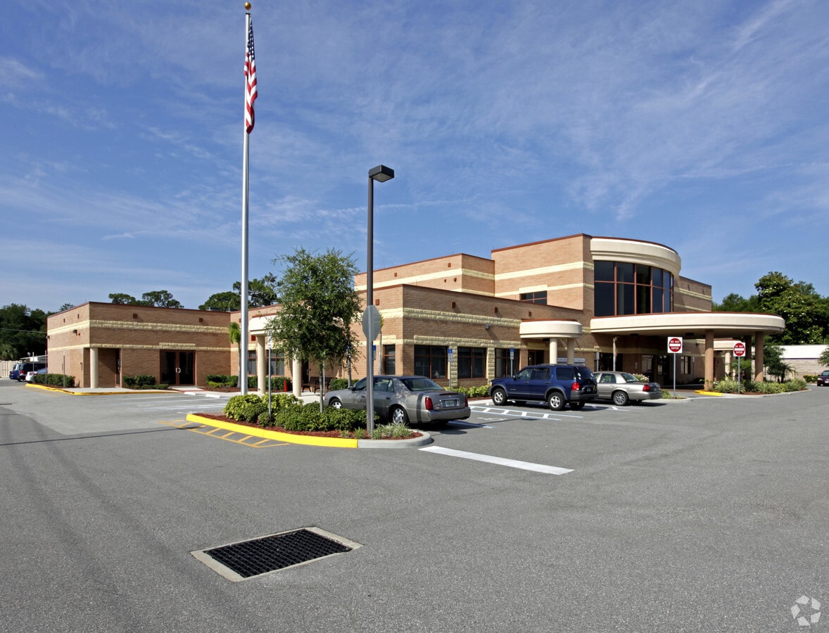
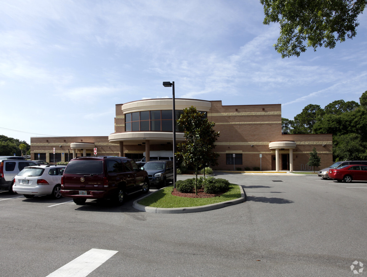
Property Record
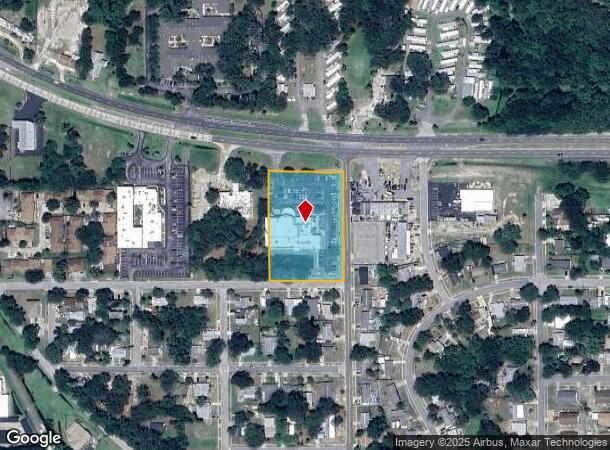
490 N Washington Ave, Titusville, FL 32796
NEARBY LISTINGS FOR SALE OR LEASE
Property Detail
490 N Washington Ave
21-35-33-00-00792.0-0000.00
E H Rices Add/Titusville
Storesoffices
W 260 FT OF E 280 FT OF SE 1/4 LYING S OF US HWY 1 & N OF PB 1 PG 6 PAR 793
X
Brevard
12009C0205H
Florida
2023
2.23 AC
2023
Brevard County
060700
Orlando
24,586 SF
Palm Bay-Melbourne-Titusville, FL
DEMOGRAPHICS near 490 N Washington Ave
1 Mile
3 Mile
5 Mile
2024 Total Population
5,692
32,768
57,689
2029 Population
6,283
35,961
63,220
Pop Growth 2024-2029
+ 10.38%
+ 9.74%
+ 9.59%
Average Age
46
44
44
2024 Total Households
2,419
13,961
24,573
HH Growth 2024-2029
+ 10.09%
+ 9.61%
+ 9.43%
Median Household Inc
$36,856
$47,973
$50,984
Avg Household Size
2.10
2.20
2.30
2024 Avg HH Vehicles
1.00
2.00
2.00
Median Home Value
$175,077
$201,957
$216,075
Median Year Built
1972
1980
1981
Nearby Places
- Restaurants
- Banks
- Shops
- Fitness
- Groceries
PUBLIC TRANSPORTATION
AIRPORT
Orlando Sanford International
DRIVE
WALK
Distance
Orlando Sanford International
70 min
46.8 mi
Freight Ports
Port Canaveral
DRIVE
WALK
Distance
Port Canaveral
39 min
25.0 mi
Nearby Properties
Address
Land Use
TOTAL SIZE
Lot Size
Zoning
Address
Land Use
TOTAL SIZE
Lot Size
Zoning
440,368 SF
60.44 AC
HM
Address
Land Use
TOTAL SIZE
Lot Size
Zoning
18,000 SF
16.54 AC
P
Address
Land Use
TOTAL SIZE
Lot Size
Zoning
301,357 SF
23.86 AC
P
Address
Land Use
TOTAL SIZE
Lot Size
Zoning
172,172 SF
116.12 AC
P
Address
Land Use
TOTAL SIZE
Lot Size
Zoning
243,389 SF
29.15 AC
RC
Address
Land Use
TOTAL SIZE
Lot Size
Zoning
267,207 SF
36.82 AC
P
Address
Land Use
TOTAL SIZE
Lot Size
Zoning
3.25 AC
P
Address
Land Use
TOTAL SIZE
Lot Size
Zoning
118,056 SF
11.52 AC
R3
Address
Land Use
TOTAL SIZE
Lot Size
Zoning
187,335 SF
5.92 AC
P
Address
Land Use
TOTAL SIZE
Lot Size
Zoning
187,335 SF
5.92 AC
P
Address
Land Use
TOTAL SIZE
Lot Size
Zoning
129,515 SF
16.15 AC
RC
Address
Land Use
TOTAL SIZE
Lot Size
Zoning
206,579 SF
15.90 AC
R3
Address
Land Use
TOTAL SIZE
Lot Size
Zoning
59,953 SF
0.71 AC
Address
Land Use
TOTAL SIZE
Lot Size
Zoning
113,576 SF
19.98 AC
P
Address
Land Use
TOTAL SIZE
Lot Size
Zoning
54,816 SF
10.11 AC
BU-1
Address
Land Use
TOTAL SIZE
Lot Size
Zoning
89,424 SF
15.31 AC
GU
Address
Land Use
TOTAL SIZE
Lot Size
Zoning
2,536 SF
75.81 AC
OR
Address
Land Use
TOTAL SIZE
Lot Size
Zoning
163,141 SF
18.58 AC
P
Address
Land Use
TOTAL SIZE
Lot Size
Zoning
95,198 SF
5.32 AC
R3
Address
Land Use
TOTAL SIZE
Lot Size
Zoning
97,463 SF
19.50 AC
P
Address
Land Use
TOTAL SIZE
Lot Size
Zoning
103,923 SF
19.41 AC
R1B
Address
Land Use
TOTAL SIZE
Lot Size
Zoning
79,548 SF
4.89 AC
R3
Address
Land Use
TOTAL SIZE
Lot Size
Zoning
151,914 SF
10.43 AC
R3
Address
Land Use
TOTAL SIZE
Lot Size
Zoning
121,859 SF
16.07 AC
R3/OR
Address
Land Use
TOTAL SIZE
Lot Size
Zoning
68,077 SF
13.60 AC
P
Address
Land Use
TOTAL SIZE
Lot Size
Zoning
164,378 SF
12.45 AC
R3
Address
Land Use
TOTAL SIZE
Lot Size
Zoning
63,902 SF
2.45 AC
R3
Address
Land Use
TOTAL SIZE
Lot Size
Zoning
86,283 SF
4.57 AC
CBD
Address
Land Use
TOTAL SIZE
Lot Size
Zoning
68,376 SF
2.57 AC
R3
Address
Land Use
TOTAL SIZE
Lot Size
Zoning
109,709 SF
5.83 AC
M1
The World's #1 Commercial Real Estate Marketplace
Connect with us
© 2025 CoStar Group
The information above has been obtained from sources believed reliable. While we do not doubt its accuracy we have not verified it and make no guarantee, warranty or representation about it. It is your responsibility to independently confirm its accuracy and completeness. Any projections, opinions, assumptions, or estimates used are for example only and do not represent the current or future performance of the property. The value of this transaction to you depends on tax and other factors which should be evaluated by your tax, financial, and legal advisors. You and your advisors should conduct a careful, independent investigation of the property to determine to your satisfaction the suitability of the property for your needs.